All official European Union website addresses are in the europa.eu domain.
See all EU institutions and bodies
An official website of the European Union | How do you know?
Environmental information systems
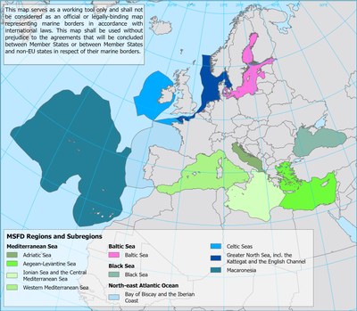
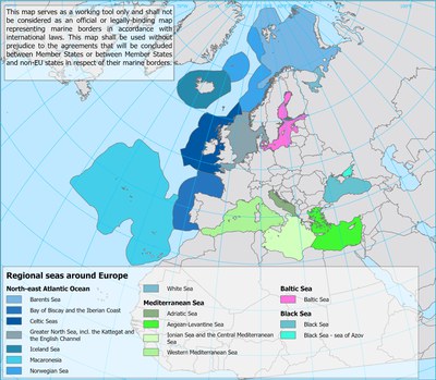
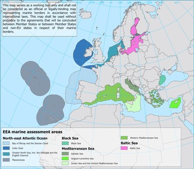
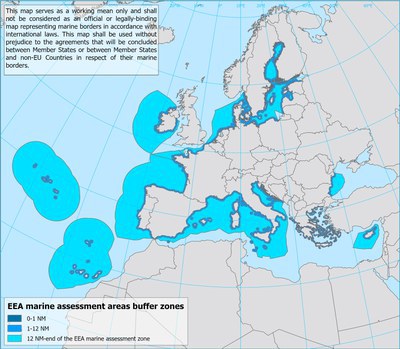
The present section makes available data and metadata of spatial datasets related with the Marine Strategy Framework Directive (MSFD) implementation, such as the marine regions and subregions, the national marine waters and the Marine Reporting Unit (MRU) provided by Member States and that represent the marine assessment areas requested by the Directive and linked to its Articles. This section offers also other spatial datasets, elaborated by the European Environment Agency (EEA) and the European Topic Centre (ETC) for statistical purposes and based on the above MSFD data.
The following spatial datasets contain restricted information and cannot be made public. The download of these datasets is thus limited to EIONET users only. Nevertheless, metadata information for these datasets is available.
- Marine waters used in Marine Strategy Framework Directive (MSFD) - INTERNAL - version 2.0, Oct. 2022
- EEA Marine waters for analysis - INTERNAL, Oct. 2022
- Marine Reporting Units used in Marine Strategy Framework Directive (MSFD) for the 2018 reporting - INTERNAL - version 3.0, Jun. 2023
Disclaimer: please note that the data shall be considered as working instrument only and not as official or legally-binding data representing marine borders in accordance with international laws. Therefore, the data shall be used without prejudice to the agreements that will be concluded between Member States or between Member States and non-EU states in respect of their marine borders. Further information for each spatial dataset is provided in their metadata page.concluded between Member States or between Member States and non-EU states in respect of their marine borders. Further information for each spatial dataset is provided in their metadata page.