All official European Union website addresses are in the europa.eu domain.
See all EU institutions and bodies
An official website of the European Union | How do you know?
Environmental information systems
Floods Directive (2007/60/EC) on the assessment and management of flood risks requires Member States to assess if all water courses and coast lines are at risk from flooding, to map the flood extent and assets and humans at risk in these areas and to take adequate and coordinated measures to reduce this flood risk.
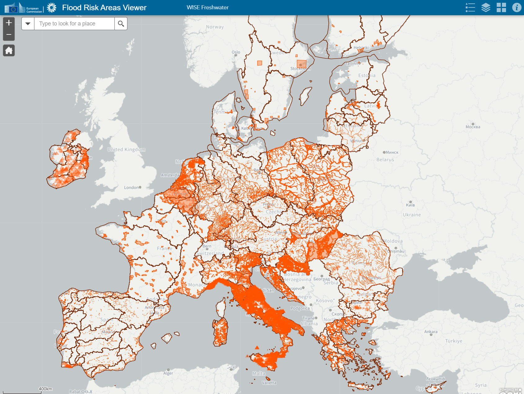
Explore the new EU flood risk areas viewer
The EU Flood risk areas viewer is provided by the European Commission with the support of the European Environment Agency to raise flood risk awareness. It reflects work carried out by the Member States under the Floods Directive. Flood risk may change over time, for various reasons. This is why Member States update periodically their flood risk assessments, flood hazard and risk maps, and flood risk management plans. For example, flood risk areas previously identified as potentially significant may cease to be considered as such, new ones may be added. The Floods Directive foresees updates every six years, the current flood risk management plans cover the period 2022-2027.
The map displays relevant information and links to the Member States’ preliminary flood risk assessments, flood hazard and risk maps, and flood risk management plans in the national language/s.
By zooming, it is possible to see which areas of potentially significant flood risk (shown with orange colour) have been identified by each Member State. Member States define what constitutes a significant flood risk depending on their particular circumstances. And they can define an area of potentially significant flood risk as a point, a line, or a polygon. Clicking on these elements, pop-up windows offer additional information.
Should you wish to contact the national authority/ies tasked with implementing the Floods Directive, consider including in your correspondence the “Unit of Management” code and the “Area of Potential Significant Flood Risk” code, if your query is area-specific.
For enquiries about this viewer please contact:
env-water@ec.europa.eu
Flooding is a natural and not uncommon process associated with river dynamics, but across Europe and throughout the ages, floods have affected human health, the environment, cultural heritage and economic activities. To address the risks of floods in Europe, the Floods Directive was composed with an aim to reduce and manage the risks that floods pose to human health, the environment, cultural heritage and economic activity. It requires Member States to assess if all water courses and coastlines are at risk from flooding, to map the flood extent and assets and humans at risk in these areas, as well as to take adequate and coordinated measures to reduce this flood risk.
The Directive also reinforces the rights of the public to access this information and to have a say in the planning process.
If you want to learn more
Further insights and checkpoint for progress in the overall implementation of the legislation, as a stepping stone towards assessment of the next generation (2022-2027) of river basin management plans (RBMPs) and flood risk management plans are available in the Implementation Reports (europa.eu)
Read more
Related Resources
Web pages
References
- The Water Framework Directive and the Floods Directive: Actions towards the 'good status' of EU water and to reduce flood risks (COM/2015/120 final)
- European Overview - Flood Risk Management Plans. Commission Staff Working Document accompanying the report.
- River Floods. EEA Indicator Assessment 2019
- The EU Floods Directive web page
- Floods Directive document
- A European Overview of the first Flood Risk Management Plans - Commission Staff Working Document accompanying the report
- River Floods – Indicator Assessment
- COMMUNICATION FROM THE COMMISSION TO THE EUROPEAN PARLIAMENT AND THE COUNCIL The Water Framework Directive and the Floods Directive: Actions towards the 'good status' of EU water and to reduce flood risks.